PaveScan RDM 2.0 is a second-generation asphalt density assessment instrument from Geophysical Survey Systems Inc. (GSSI) that is ideal for revealing abnormalities that occur during the paving process, such as low consistency and significant density variances. By recognizing problems, PaveScan RDM 2.0 helps prevent early failures including road raveling, cracking and deterioration along joints.
As of April 2019, the American Association of State and Highway Transportation Officials (AASHTO) approved this pavement density measurement technique, PP 98-19.
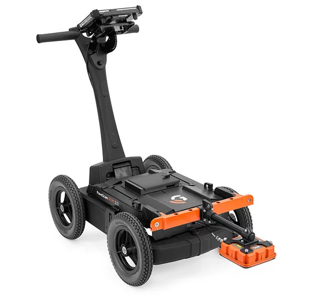
Image Credit: Geophysical Survey Systems, Inc.

Image Credit: Geophysical Survey Systems, Inc.
Applications
- Non-destructive testing of asphalt compaction
- Quality assurance/quality control of new pavements
- Evaluating pavement non-conformity
Modern Technology to Determine New Pavement Quality
PaveScan RDM 2.0 uses new pavement dielectric tests to determine pavement condition and uniformity. This is said to be the first of its kind in the world.
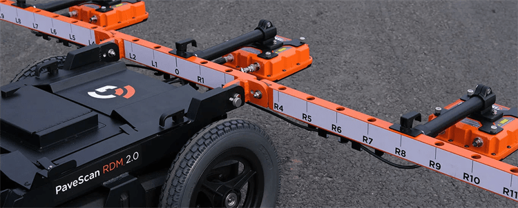
Image Credit: Geophysical Survey Systems, Inc.
Innovative Technology
The PaveScan RDM 2.0 is a piece of low-cost, non-destructive evaluation equipment for detecting asphalt dielectric at the time of application. This technique is ideal for exposing irregularities that occur throughout the paving process, such as low homogeneity and significant density variances.
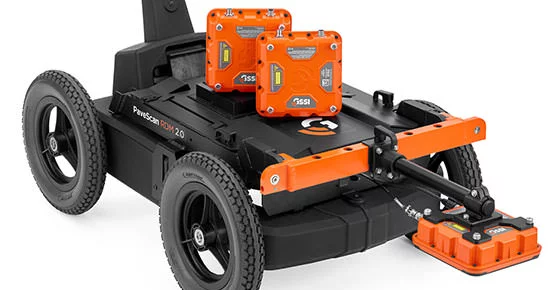
Image Credit: Geophysical Survey Systems, Inc.
Groundbreaking Solutions
The PaveScan RDM 2.0 is the industry’s most advanced asphalt test technique for identifying non-conformity in new pavement. It might be used with either the percent voids or the dielectric values survey approaches. As with nuclear gauges or radioactive equivalents, there are no site dangers or the requirement to seal off work areas.
Image Credit: Geophysical Survey Systems, Inc.
Data Visualization
The PaveScan RDM 2.0 is easy to use for everyone, from technicians to engineers. This technology is ideal for government transportation agencies and paving contractors alike, thanks to permanent real-time onscreen data output, GPS integration and export possibilities.
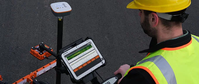
Image Credit: Geophysical Survey Systems, Inc.
Data Examples
Single Sensor
The color map highlights irregularities in the direct measurement, making it easy for professionals to spot areas of concern.
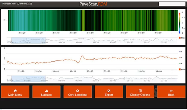
Image Credit: Geophysical Survey Systems, Inc.
Three Sensors
The line chart depicts a three-sensor system, with each line adding up to the sensor’s dielectric output.

Image Credit: Geophysical Survey Systems, Inc.
Google Earth Image
The data depicts a Google Earth image that was instantaneously exported as a .kml file using PaveScan RDM. The density levels of newly constructed compacted pavement are seen in this photograph. Low-density regions are blue, while bridges are blue in the center.
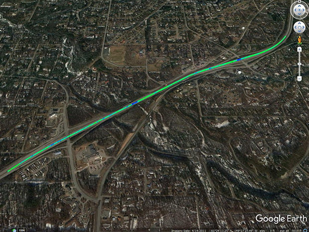
Image Credit: Geophysical Survey Systems, Inc.
Specifications
Source: Geophysical Survey Systems, Inc.
| Tablet computer |
| Display |
10.1" WUXGA 1920 x 1200 with LED backlighting |
| Processor |
Intel® i5-7300U |
| Available ports |
Ethernet, USB, HDMI |
| Battery |
Li-Ion Battery Pack (10.8 V), 4 hours |
| Operating temperature |
-28 °C to 60 °C (-18 °F to 140 °F) |
| Environmental rating |
IP65 |
| Drop spec |
MIL-STD-810G |
| System specifications |
| Data format |
.csv |
| Maximum output resolution |
.4 inch (1 cm) |
| Operating mode |
Survey wheel distance-based data collection |
| Power source |
2 x 10.8 V 8.2 AH batteries |
| Diagnostic |
Battery indicator status, hard disk capacity |
| Measurement specification |
| Repeatability (Dielectric) |
+/- 0.08 (value obtained from HDPE validation blocks) |
| Accuracy (Dielectric) |
+/- 0.08 (value obtained from HDPE validation blocks) |
| Minimum/Maximum dielectric |
2 to 16 |
| Mechanical |
| Dimensions |
One sensor cart system – 36.9 kg (81.4 lbs), Three sensor cart system – 42.9 kg (94.6 lbs) |
| Environmental rating |
IP65 |
| Operating temperature |
-28 °C to 60 °C (-18 °F to 140 °F) |
| Storage temperature |
-55 °C to 85 °C (-67 °F to 185 °F) |
Includes:
- 2.1 m digital control cable(s)
- User manual
- Panasonic Toughpad G1
- 2 GHz sensor (1 or 3)
- Lithium-ion battery (2)
- Four-wheel cart
- Concentrator box
- Two-year warranty
- Dual-bay battery charger
Accessories
The PaveScan upgrade kit allows customers with a single sensor to upgrade to a three-sensor system for increased pavement coverage. The accessories include two wires, two sensors and arm extensions.
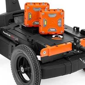
Image Credit: Geophysical Survey Systems, Inc.