The release of greenhouse gas (GHG) emissions into the environment as a result of human activities is considered to be the primary driver of climate change. The increased concentration of GHG in the environment increases the global temperature, which can ultimately result in a myriad of unwanted effects on the atmosphere, land, and oceans.
This increase in atmospheric temperatures can enhance evaporation, which subsequently reduces the amount of surface water, drying out soil and vegetation. Additionally, climate change can also impact the availability of water in these dryer areas, increasing the likelihood of droughts.
Aside from making certain areas more prone to droughts, climate change can also cause droughts to become more frequent, intense, and longer-lasting. For example, water levels of South America’s second-largest river after the Amazon, which is known as the Paraná river, recently hit their lowest since 1944. This drought, which is likely the result of extensive deforestation and climate change of this region, has threatened both the livelihoods of local fishermen and the availability of drinking water to more than 40 million people.
Current Sensing Methods to Predict Droughts
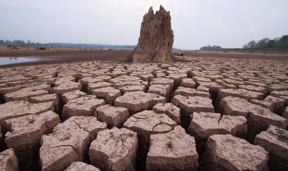
Image Credit: Piyaset/Shutterstock.com
There are several different indices that have been developed to predict the severity of a drought. The standardized precipitation index (SPI), for example, is calculated using rainfall data acquired from a ground station. However, its utility in predicting agricultural droughts is limited as it is entirely dependent upon rainfall data.
Comparatively, the vegetation condition index (VCI) is a satellite-based drought index that is a modification of the normalized difference vegetation index after the potential maximum and minimum of an ecosystem have been considered. Additional satellite-based drought indexes include vegetation health index (VHI), soil wetness deficit index (SWDI), and scaled drought condition index (SDCI).
Taken together, remote sensing platforms play an important role in the ability of climate scientists to predict the intensity and severity of droughts. Remote sensing data has also reduced the uncertainty surrounding drought severity predictions, while also offering an independent observational capacity to judge these future events.
Some of the different drought characteristics that can be predicted by multi-sensor remote satellites include precipitation, temperature, soil moisture, terrestrial water storage, evaporation, snow, vegetation response, and plant function.
For the remote sensing of groundwater and surface water storage, for example, NASA’s Gravity Recovery and Climate Experiment (GRACE) satellite has become an increasingly useful tool in providing insights on drought behavior. Furthermore, Interferometric Synthetic Aperture Radar (InSAR) sensors have also been used to for precisely determining the magnitude of surface deformation and subsidence.
Climate Change and Floods
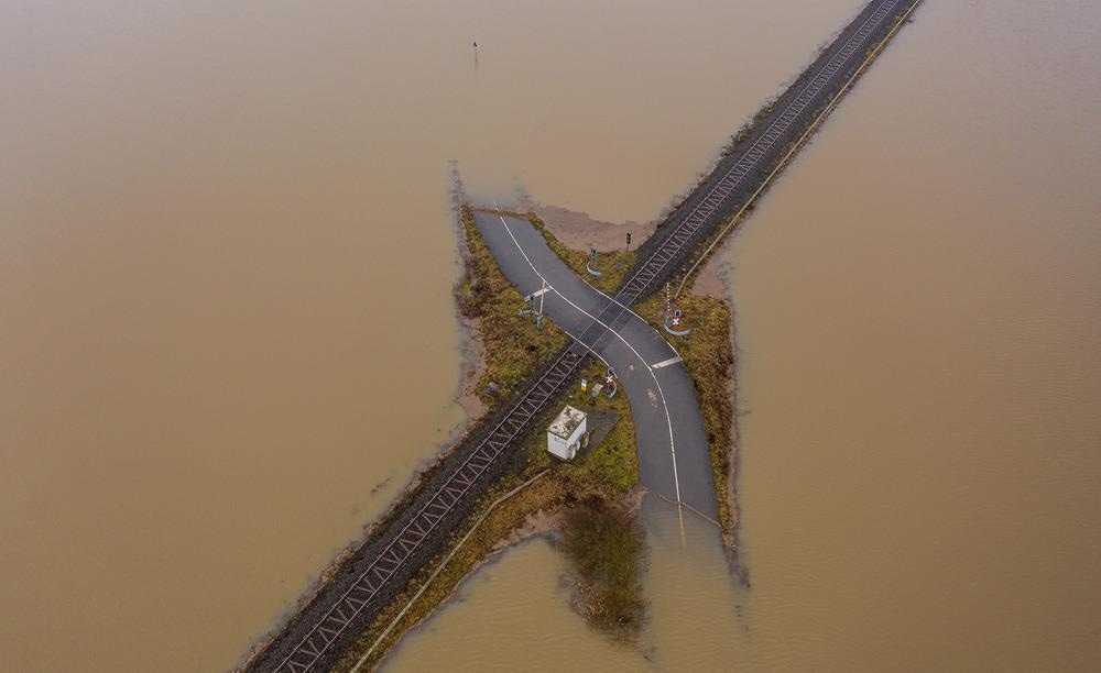
Image Credit: bear_productions/Shutterstock.com
In addition to reducing the availability of water to dry areas, climate change has also been linked to extreme rainfall events that have caused massive flooding in many areas around the world.
Within the coastal communities across the United States, for example, record-setting high-tide flooding has already caused costly and deadly events to occur over the past year.
While the cause-and-effect relationship between climate change and droughts may appear obvious, there is also a clear link in how climate change can increase the change and severity of floods. A warmer atmosphere holds a considerably higher amount of water that can subsequently lead to heavier precipitation events each time that it rains. Throughout the Northeastern states of the United States, the most extreme storms were found to generate about 27% more moisture than what was recorded over 100 years ago.
A warmer climate has also been shown to cause the glaciers and ice sheets throughout the world to melt, increasing global sea levels. Recent estimates indicate that the world’s oceans are seven to eight inches higher than they were in 1900, with the Intergovernmental Panel on Climate Change (IPCC) predicting that these levels will reach between 1-4 feet above these levels by the end of the century.
Remote Sensing for Flood Prediction
For several decades, both topical and radar remote sensing systems on both satellites and aircraft have provided critical information for determining the extent of flood, assessing the damage, and providing information to predict the vulnerability of certain inland and coastal areas to floods.
The ability to accurately predict the vulnerability of an area to flooding is essential for habitat conservation and protection planning processes. Furthermore, such flood prediction processes can also assist local emergency services in preparing for potential flood-induced hazards.
In coastal locations, scientists have often relied on high-resolution satellite imagery and airborne LIDAR data for flood risk mapping from storm surge events. Typically, the National Oceanic and Atmospheric Administration will utilize the SLOSH model to predict storm surge heights and winds from hurricanes. More specifically, the SLOSH motel utilizes remote sensing data to determine the pressure, size, forward speed, track, and wind speed of a hurricane. This information can assist local officials in determining which areas are most at risk from the storm surges and should therefore be evacuated.
As compared to ground stations, which are often insufficient in their ability to predict precipitations of severe rainstorms, satellite precipitation products (SPPs) are better equipped to predict flood discharge from extreme rainstorms. SPPs have been used to complement current flood forecasting protocols by accurately predicting flood discharge and assist in flood extent mapping.
References and Further Reading
Drought and Climate Change [Online] Available from: https://www.nature.com/articles/s41586-021-03901-9
South America’s drought-hit Paranáriver at 77-year low. [Online]. Available from: https://www.bbc.com/news/world-latin-america-58408791
Flooding and Climate Change: Everything You Need to Know. [Online]. Available from: https://www.nrdc.org/stories/flooding-and-climate-change-everything-you-need-know
Jiao, W., Wang, L., & McCabe, M. F. (2021) Multi-sensor remote sensing for drought characterization: current status, opportunities and a roadmap for the future. Remote Sensing of Environment 256. https://doi.org/10.1016/j.rse.2021.112313
Klemas, V. (2015) Remote Sensing of Floods and Flood-Prone Areas: An Overview. Journal of Coastal Research 31(4); 1005-1003. http://dx.doi.org/10.2112/JCOASTRES-D-14-00160.1
Belabid, N., SZhao, F., Brocca, L., et al. (2019). Near-Real-Time Flood Forecasting Based on Satellite Preciptiation Produxts. Remote Sensing. https://doi.org/10.3390/rs11030252
Disclaimer: The views expressed here are those of the author expressed in their private capacity and do not necessarily represent the views of AZoM.com Limited T/A AZoNetwork the owner and operator of this website. This disclaimer forms part of the Terms and conditions of use of this website.