Image Credit: Geoscience Australia
The Australian Passive Seismic Array Project (AusArray) is a national survey undertaken collaboratively between governments and academia.
The project stems from the passive seismic deployments initiated by the Australian National University in the 1990s, co-founded by Auscope, and has been supported by the Exploring for the Future program since 2016.
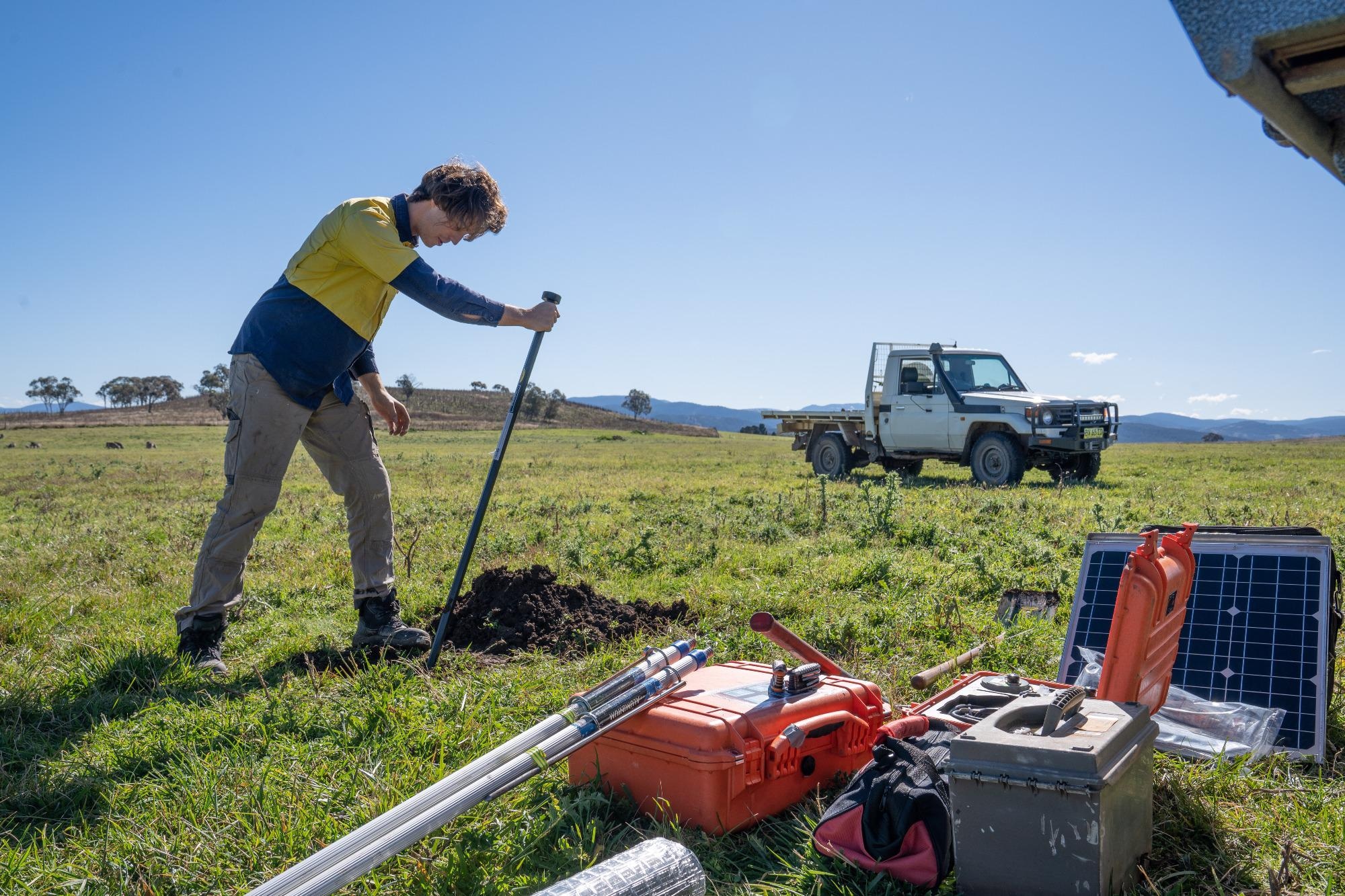
Geoscience Australia’s Senior Science Advisor to the Exploring for the Future program, Dr Karol Czarnota, said from April to June 2022, scientists will deploy sensors at up to 186 sites across the country.
These sensors will gather data for more than a year, which will be used to develop a three-dimensional model of Australia’s sub-surface geology across the whole continent, Dr Czarnota said.
“These sensors measure the small natural vibrations that travel through the Earth, which can be caused by earthquakes thousands of kilometres away, waves breaking on the shore, or even the wind,” Dr Czarnota said.
"By working out the speed of this seismic wave, we can build a picture of the distribution of different rock types beneath the surface, from depths of a few metres to hundreds of kilometres.
”With help from our partners in the state and Northern Territory geological surveys and academia, we are burying these sensors – which are about the size of a 2-litre milk bottle - on a 200-kilometre spaced grid across the country.
“This survey will be the first to cover an entire continent at once at this spacing. This is significant because it gives us the big picture about Australia’s geology, from a perspective we have never been able to view it from before.”
Past AusArray surveys have covered smaller areas of the continent at 50-kilometre grid spacing, Dr Czarnota explained.
“For example, from 2016 to 2020, the Exploring for the Future program supported deployment of AusArray instruments at more than 200 sites across the Northern Territory and Queensland on a 50-kilometre spaced grid,” Dr Czarnota said.
“The results from this deployment revealed new subsurface features that helped explain the geological evolution of northern Australia, revealed a new basin and provided explorers with new insights into the potential for discovering new mineral and energy resources.
“Data from 50-kilometre spaced AusArray deployments also allowed for better characterisation of Australian earthquakes, which is improving our natural hazard modelling and make our communities safer.”
The data from the 200 kilometre-spaced deployment will support the development of a general geological framework of Australia, which can then be used by researchers to identify areas for closer examination.
Exploring for the Future is an Australian Government program, led by Geoscience Australia, which is transforming the national picture of Australia’s geology.