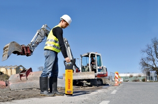
Underground service locators enable workers to locate buried utilities in order to avoid injury and damage during excavation. Following the success of its previous series of locators, Leica Geosystems has extended the range of features in its new Digicat 700 Series, providing users with greater confidence in their results due to greater traceability.
In addition to data logging, Bluetooth® connectivity, depth estimation and tracing frequencies, the 700 Series is the only range of locators that offers fully integrated GPS technology.
The added GPS feature helps to deliver the ‘where’ in locating and tracing buried utilities by easily and conveniently displaying the collected geographical data on a map. The software provides information on where the locator has been used – which can then be downloaded via Bluetooth® to a PC, mobile phone or tablet – offering customers increased confidence in the traceability of locating activities. The Leica Geosystems Digicat 700 Series is highly durable, weatherproof and offers flexible operating modes to suit most site conditions and terrains.
Additional integration for complete traceability
As with the previous series of locators, the Leica Digicat 700 Series also offers automatic pinpointing, enabling easier and more efficient utility locating and removing the need for manual tuning. Its fully integrated data logging feature provides users with visibility of activities by providing information on how and when the locator has been used, and the Bluetooth® feature facilitates logged usage data to be downloaded from the locator at the user’s convenience.
The Leica Digicat 700 Series locators provide various options for two market segments. Designed to avoid damage during the excavation process, the 700i and the 750i are used to scan a set area, identifying whether there are any buried utilities that might present a danger to the person excavating. Conversely, the 750i xf is used for the same applications as the Digicat 700i & 750i with additional tracing frequencies, and is ideal for long distance tracing of buried utilities.
Workforce benefits
“This next generation of locators provides users with increased confidence in their locating results and efficient handling through fully integrated technology. The complexity of underground utilities networks continues to increase, so providing greater traceability to obtain information about the use of the equipment has never been so important,” says Andrew Allen, Product Manager at Leica Geosystems. “By helping to reduce - and ultimately prevent - utility damage, our new Digicat 700 Series offers customers enhanced safety and greater efficiency.”