Image Credit: Cynthia A Jackson/Shutterstock.com
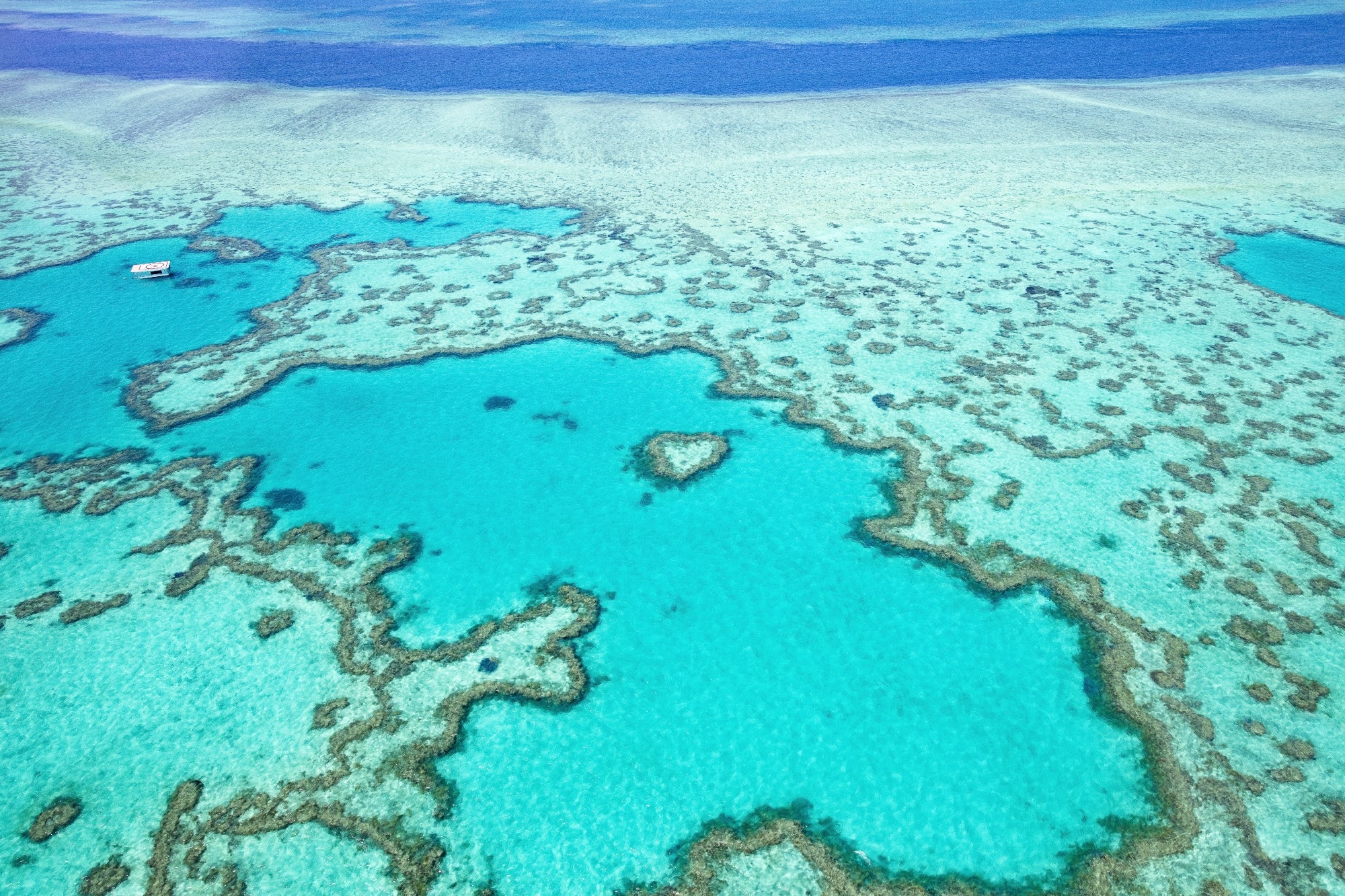
Coral reefs play a crucial role in the marine ecosystem, supporting diverse species and sustaining industries such as fisheries, tourism, and recreation. But these delicate ecosystems face growing threats from climate change, particularly rising ocean temperatures that stress coral and the symbiotic algae they rely on.
The new tool, developed in partnership with SHAMS and the General Organization for the Conservation of Coral Reefs and Turtles in the Red Sea, offers an effective and efficient way to track bleaching events and prioritize areas for intervention. While tailored for the Red Sea, the system can be adapted for use worldwide.
Coral bleaching occurs when environmental stress causes corals to expel the algae that supply them with nutrients and color. Without these algae, corals turn white and become more vulnerable to disease and death. Prolonged bleaching can devastate entire reef systems.
Monitoring the health of coral reefs amid climate change is crucial, and satellite remote sensing provides a cost-effective strategy that is more efficient than traditional field sampling, which can be time-consuming and resource-intensive.
Elamurugu Rajadurai Pandian, Postdoctoral Researcher, King Abdullah University of Science and Technology
Unlike earlier approaches that simply detected bleaching, the new system also evaluates the severity of bleaching. This allows for rapid classification of affected areas, helping conservationists make quicker and more informed decisions.
Pandian added, “Healthy and bleached corals reflect light differently, and satellites can detect these variations.”
They analyzed how light is reflected off the ocean floor by both healthy and stressed corals, applying a mathematical method known as the least-squares approach to uncover consistent patterns and distinguish bleached reefs with high precision.
One challenge in using satellite imagery over the Red Sea is atmospheric interference from nearby deserts, where frequent dust storms introduce noise into the data.
“The detection accuracy depends on the atmospheric correction of satellite imagery, which is complicated by the Red Sea’s proximity to deserts and frequent dust storms. We used an advanced algorithm that removed erroneous reflectance values caused by aerosols and particulates. This significantly improved the accuracy of satellite ocean color data retrievals in our model, particularly over the complex, reef-filled shallow waters of the Red Sea,” Pandian noted.
The tool also offers enhanced spatial resolution, delivering coral health assessments every ten meters. This level of detail helps scientists better understand not just where bleaching is happening, but how severe it is - and how reefs might respond over time.
By serving as an early warning system for coral bleaching, our method will enable faster responses and better conservation strategies. Such high-resolution monitoring will support sustainable fisheries and tourism management while also contributing to climate change research by tracking environmental changes in marine ecosystems.
Ibrahim Hoteit, Professor, Earth Sciences and Engineering, King Abdullah University of Science and Technology
Journal Reference:
Gokul, E. A. et al. (2025) Remotely sensing coral bleaching in the Red Sea. Remote Sensing in Ecology and Conservation. doi.org/10.1002/rse2.70000.